


The July walk saw another step in our gradual move back to normal. As requested and recommended by Dr. Bonnie, we divided into small groups rather than walking as one large group (three groups; creatively named Group 1, Group 2, and Group 3). Group 1 (guided by Dave) departed at 10:15; Group 2 (guided by Michael) departed at 10:30; and Group 3 (guided by Fred) departed at 10:45. Average group size was 6.67 Loopers (though, if Maisie is considered to be a Looper, Group 1 had 8). Starting selfies for the three groups are shown above, demonstrating (at least in two out of three cases) safe social distancing.
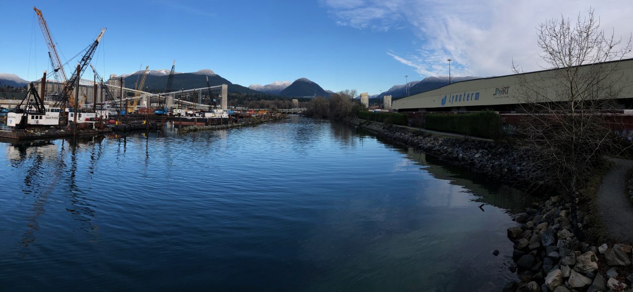
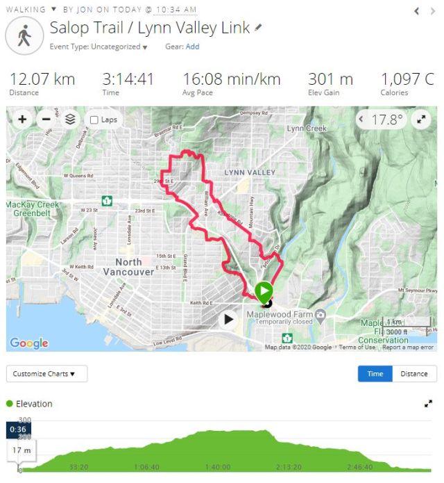
And this time, for the first time in several months, everyone walked the same route! Our route (a circular route on the North Shore) had been devised and pioneered by Looper Zero, aka Dave. Starting point was Bridgman Park (beside Lynn Creek), continuing generally clockwise (and generally uphill) from there to Princess Park (which we’ve previously visited during the Burrard Loop series of walks). From Princess Park the route continued (generally downhill, and generally following the Lynn Valley Link Trail) back to Lynn Creek and our endpoint at Bridgman Park. An overview of the route, with some stats, is shown at the end of this post.
Groups started by crossing under Keith Road bridge, up to street level, then west, to the start of the Salop Trail, the first part of which has become known as the North Shore Rock Walk, due to a stunning collection of painted rocks. Experts are still debating the origins of these painted rocks: possibly they represent early indigenous art; possibly they are of a more recent date. Some examples are shown below.


Following Salop Trail we passed beneath the new Mountain Highway overpass, continuing uphill (with Highway 1, a.k.a. the Upper Levels Highway, to our right) past Loutet Farm and Sutherland School, eventually reaching Lynn Valley Road, where we crossed under Highway 1.


Continuing uphill, past a water feature (to Tempe Crescent and beyond!) we eventually crossed 29th St (which Michael remembers, from the days of his Lynn Valley youth, as being The Ultimate Test for a cyclist: pedalling uphill and over), and soon reached Princess Park: a perfect site to pause for a snack. Here—despite our staggered start times—all three groups were, at least briefly, simultaneously in Princess Park. Despite the obvious temptations, we nonetheless managed to maintain safe social distancing (more or less) at all times.


Leaving Princess Park we passed through a stretch of highly photographable trees, continuing along the Lynn Valley Link Trail, which here follows (more or less) the power line downhill. Recrossing 29th St we passed through a residential district whose street names celebrate famous poets: William Ave, Shakespeare Ave, Milton Ave, Chaucer Ave, Tennyson Crescent, Dryden Way, Masefield Rd (and Viney Rd — presumably after the lesser-known poet Dave Viney).


Crossing Lynn Valley Road near Mollie Nye House, we passed the Karen Magnussen Rec Centre, then down the power line to, and across, Mountain Highway. At the Arborlynn Drive Trail Head we picked up the trail leading downhill to Lynn Creek, crossing to the east bank and then downstream to (and under) Highway 1 and Keith Road, where we crossed back to Bridgman Park to end.


Most people had brought folding chairs, which were arranged into a large circle in a shady grove at Bridgman Park, so that all could visit safely en masse. And a splendid time was had by all!


Photo credits to: Jon, Angela, Michael, Adrienne, Sandy, Janet S., Maurice, and Fred (and possibly others?)

I don’t see Dave as Looper Zero – he’s more like a 10 – our fearless leader!
Also, is Tumblr sponsoring the rock wall only, or the whole blog? Carol
LikeLike
Pingback: 2021 April 4 – Loopers